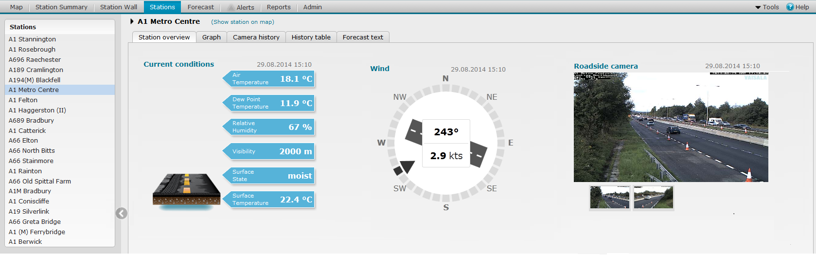
The Stations View displays detailed road weather data from one station on several tabs:
Station Overview tab, including camera images from the site (when available), present weather and road surface state information, and wind display. Also active alerts for the station are displayed.
Graph tab, displaying weather observation trends, and forecasts, when available.
Camera history tab, displaying the available camera images from the last 24 hours.
History table tab, displays the available data from the station from the last 24 hours.
Forecast text tab, forecast for the area of the station, if available.
Metadata for the station, when available.
TIP: To see short descriptions, move the mouse pointer over different parts of the picture:
You can open the Stations view in the following ways:
Click the Stations tab in the application toolbar.
Click the station name in the Station Summary View.
Click the station name in the Station Wall View.
Double-click the station marker in the Map View.
NOTE:
For station markers that indicate station clusters,
zoom in first until the marker indicates only one station.
Select the station from the list in the side panel.
If the selection panel is not displayed, click the arrow icon on the
left:
![]()
If station is not displayed in the side panel, check that you have selected
the correct group or subgroup from the drop-down list in the application
header.
![]()
The images and data are refreshed automatically every 5 minutes.
To manually refresh the data, use the Refresh button of your Internet browser.
Click the station name at the top of the Stations View. The following is displayed at the top of the view:
Station coordinates
Nearest stations
Groups in which the station belongs to
To view archived data, select the archive mode by clicking the Archive button in the application header. See topic Archived Data Basics.
See also: